|
|
 |

|
|
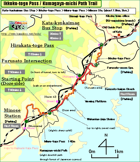
About 8km, About from 2hrs. and 30mins. to 3hrs.:From Kata-kyokai-mae Bus
Stop to Minose Station
--- Easy walk |
|
|
This trail is along a beautiful seaside of Kii-Nagashima following gentle
slopes.
It is a easy walking, enjoying a view of Kumano-nada Sea and islands. And
you can enjoy the atmosphere of some town areas of Kii-Nagashima- Furusato,
Doze and Miura. Furusato is famous for it's beautiful beach
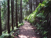
Kumagaya-michi Path, a part of world heritage, is through a beautiful forest
of Japanese cypress and ferns. |
| "Ikkoku-toge Pass/Kumagaya-michi Path Trail" brief Map |
|
 click a map and you can see a big PDF map for printing click a map and you can see a big PDF map for printing |
|
| Kata-kyokaimae Bus Stop ->(uphill and even, unpaved road, 40mins.)-> Hirakata-toge Pass ->(small downhill and even, paved road, 20mins.)-> Furusato Intersection ->(uphill-even-downhill-even, partly unpaved road, 50mins.)-> Starting Point ->(uphill-even-slight downhill, partly paved road, 50mins.)-> Minose Station |
|
|
| by car |
Nagoya ==(Highway & Route 42 / 2hrs. and 40mins.)== Kata-kyokaimae
Bus Stop ==(Route 42 / 5mins.)== Minose Station |
| by train |
Nagoya Station ==(Nanki Express / 2hrs.)== Kii-Nagashima Station ==(Local
/ 10mins.)== Minose Station |
|
|
|
 |