|
|
 |

|
|
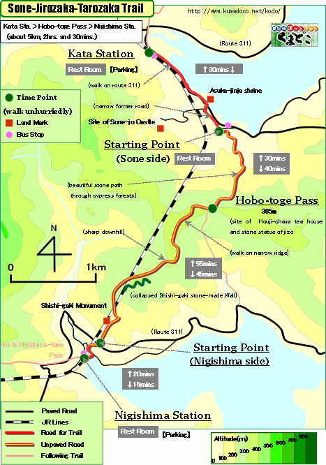
About 5km, About 2hrs. and 30mins.: From Kata Station to Nigishima Station
--- a little hard walk |
|
|
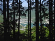
This trail is passing Hobo-toge Pass. This pass was the boundary between
Shima Country and Kii Country. It is said that the name of "Jirozaka"
is from "Jiryo," and "Tarozaka" is from "Taryo."
("zaka" means slope.) In Japanese, "Jiryo" means "own
land", and "Taryo" means "other's land."
This trail has some good stone path, and there is site of "Sekisyo,"
a cheking point in feudal era Japan, and so on.
Many part of this trail was reconstructed by the man living in Kata-cho.
As same as other trails of "Ise-ji Route," this trail was taken
care of by local people. |
| "Sone-Jirozaka-Tarozaka Trail" brief Map |
|
 click a map and you can see a big PDF map for printing click a map and you can see a big PDF map for printing |
|
| Kata Station ->(even, paved road, 30mins.)-> Starting Point(Sone-cho side) ->(uphill, stone path, 40mins.)-> Hobo-toge Pass ->(downhill, unpaved road-stone path, 45mins.)-> Starting Point(Nigishima-cho side) ->(downhill, unpaved road-paved road, 15mins.)-> Nigishima Station |
|
|
| by car |
Nagoya ==(Highway & Route 42 / 3hrs. and 50mins.)== Kata Station ==(Route311/15mins.)==
Nigishima Station |
| by train |
Nagoya Station ==(Nanki Express / 2hrs. and 30mins.)== Owase Station
==(Local / 25mins.)== Kata Station ==(Local / 5mins.)== Nigishima Station |
|
|
|
 |